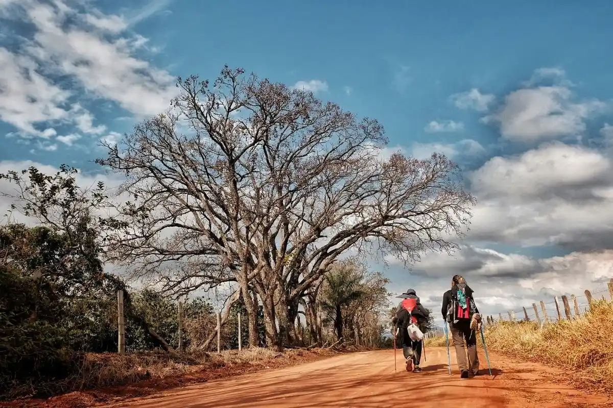
Caminho da Fé Águas da Prata, São Paulo, Brasil
Description The Path of Faith is a Brazilian pilgrimage route, inspired by the ancient Camino de Santiago de Compostela. It was developed to provide structure for those making a pilgrimage to the National Sanctuary of Aparecida, offering support points and information along the entire route.
The Path of Faith consists of over 2000 km, of which approximately 400 km traverse the mountains of the Serra da Mantiqueira via rural roads, trails, woods, and asphalt. With beautiful landscapes and welcoming communities, the Path offers moments of reflection and faith, physical and psychological health, and a connection between humans and nature. There are several branches that make up the Path of Faith, all leading to the Sanctuary of Aparecida. The main one is from Águas da Prata to Aparecida.
Photos: Path of Faith collection (Path of Faith and Brazilian Trail Network websites)
Activities Activity Hiking
Time 80h 0m
Activity Cycling
Time 56h 0m
Guidelines Extension: 317 Km Difficulty Hard Orientation Easy Signaling Level Complete Conservation Good Risk Exposure Low Sun Exposure Medium Hydration Point Available Climbing No climbing required Minimum Altitude: 579m Maximum Altitude: 1820m Negative Unevenness: 1924m Positive Unevenness: 2514m
What the trail offers Viewpoints Flora Farm Avifauna Community Tourism Rock Formations Waterfall Mountain Range Ranch Visitor Center
Discover the segments of Caminho da Fé
Show all reviews
Map Guidelines Extension: 317 KmDifficulty: HardOrientation: EasySignaling Level: CompleteMinimum Altitude: 579m Maximum Altitude: 1820m Negative Unevenness: 1924m Positive Unevenness: 2514m Route With over 2,000 kilometers, the long-distance trail Caminho da Fé has several branches, the main one located between the municipalities of Águas da Prata and Aparecida, where the Sanctuary of Aparecida is found, covering about 317 km. On this branch, the walk crosses the Serra da Mantiqueira, amidst the Atlantic Forest, where about 90% of the path is on local roads. The sections average 25 to 30 km in length, with quite variable elevation along the Caminho - having a difficult level at some points. There are rest areas, potable water, and shaded sections. There are crossings over bridges and narrow stretches, requiring greater attention from walkers or cyclists. Most of the trail is on dirt roads, with transitions to asphalt in some sections. In all the towns along this main branch, from Águas da Prata to Aparecida do Norte, as well as in the other branches of the Caminho da Fé, there are facilities for overnight stays and logistics for resupply and maintenance. The Caminho da Fé can be done on foot or by bicycle. It is also allowed to travel the Caminho da Fé by motorcycle. It is also possible to do it with a support vehicle - to carry supplies and other equipment for walkers and cyclists.
Many towns participate in the Caminho da Fé route, both in this main branch and in others. In São Paulo, there are Aguaí, Águas da Prata, Aparecida, Boa Esperança do Sul, Borborema, Campos do Jordão, Dumont, Espírito Santo do Pinhal, Franca, Guaratinguetá, Ibitinga, Leme, Nova Europa, Novo Horizonte, Patrocínio Paulista, Pindamonhangaba, Ribeirão Bonito, Ribeirão Preto, São Carlos, São João da Boa Vista, and São José do Rio Preto. In Minas Gerais, some of the towns on the route are: Andradas, Arceburgo, Borda da Mata, Botelhos, Caldas, Campestre, Consolação, Estiva, Guaxupé, Inconfidentes, Monte Santo de Minas, Monte Sião, Ouro Fino, and Paraisópolis.
Get to know other Long-Distance Trails. Trilha Interparques Travessia Guadakan Caminhos da Ibiapaba Rota das 10 Cachoeiras Estrada do Pau Brasil - Caminhos do Brasil Original Trilha de Itaúnas


 Extension: 317 Km
 Difficulty Hard
 Orientation Easy
 Signaling Level Complete
 Conservation Good
 Risk Exposure Low
 Sun Exposure Medium
 Hydration Point Available
 Climbing No climbing required
 Minimum Altitude: 579m
 Negative Unevenness: 1924m
 Positive Unevenness: 2514m
 Viewpoints
 Flora
 Farm
 Avifauna
 Community Tourism
 Rock Formations
 Waterfall
 Mountain Range
 Ranch
 Visitor Center